
Unlocking the power of AI for Public Safety
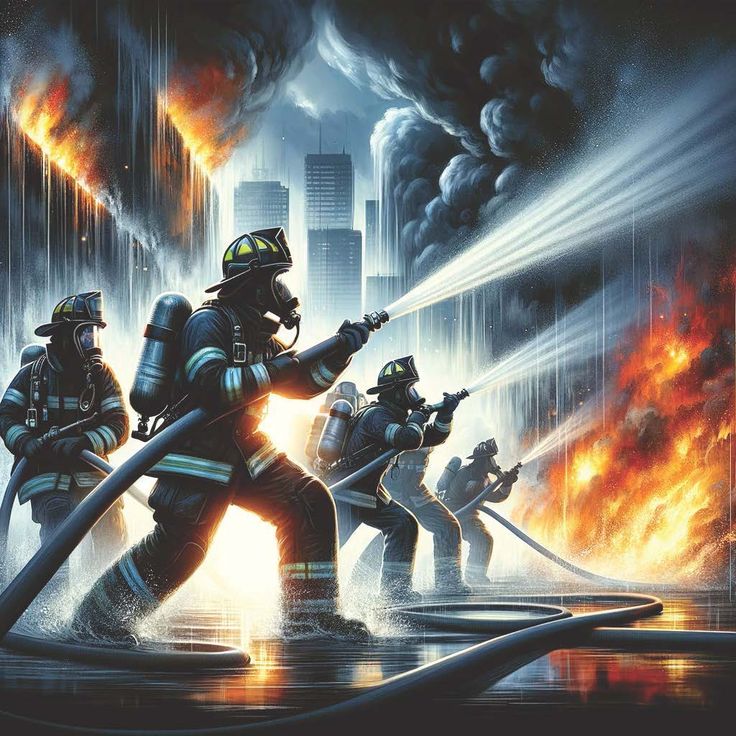
Enhancing Emergency Response with
AI-Powered Drones
Enhancing Emergency Response with
AI-Powered Drones
Enhancing Emergency Response with
AI-Powered Drones
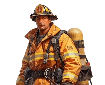
In collaboration with FirstNet by AT&T and the Crisis Technologies Innovation Lab, our team worked with Texas DPS (Department of Public Safety) and firefighters to explore the potential of AI-powered drones for fire mapping and disaster response. This project aimed to improve situational awareness, optimize emergency workflows, and enhance real-time decision-making for first responders through the use of advanced AI and geospatial technologies.
Challenge
How can AI-powered drones enhance emergency response and public safety?
Disasters such as wildfires require rapid, informed responses. First responders face challenges in assessing fire spread, coordinating rescue efforts, and ensuring personnel safety. Traditional mapping methods are often slow and resource-intensive, limiting real-time decision-making.
Disasters such as wildfires require rapid, informed responses. First responders face challenges in assessing fire spread, coordinating rescue efforts, and ensuring personnel safety. Traditional mapping methods are often slow and resource-intensive, limiting real-time decision-making.
Disasters such as wildfires require rapid, informed responses. First responders face challenges in assessing fire spread, coordinating rescue efforts, and ensuring personnel safety. Traditional mapping methods are often slow and resource-intensive, limiting real-time decision-making.
Key Problems Identified
Key Problems Identified
Key Problems Identified

Limited real-time visibility
Delayed situational updates lead to ineffective resource allocation.
Limited real-time visibility
Delayed situational updates lead to ineffective resource allocation.
Limited real-time visibility
Delayed situational updates lead to ineffective resource allocation.

Adoption barriers
First responders need AI solutions that integrate seamlessly into existing workflows.
Adoption barriers
First responders need AI solutions that integrate seamlessly into existing workflows.
Adoption barriers
First responders need AI solutions that integrate seamlessly into existing workflows.

Manual data processing
Fire mapping and analysis require extensive manpower.
Manual data processing
Fire mapping and analysis require extensive manpower.
Manual data processing
Fire mapping and analysis require extensive manpower.
Revolutionizing Emergency Response with AI-Driven Insights and Real-Time Decision-Making
Revolutionizing Emergency Response with AI-Driven Insights and Real-Time Decision-Making
Revolutionizing Emergency Response with AI-Driven Insights and Real-Time Decision-Making
Overview
By integrating AI-powered drones, computer vision, and geospatial intelligence, we empower first responders with real-time data, predictive analytics, and automated fire mapping ensuring faster, smarter, and safer emergency response.
By integrating AI-powered drones, computer vision, and geospatial intelligence, we empower first responders with real-time data, predictive analytics, and automated fire mapping ensuring faster, smarter, and safer emergency response.
Approach
Research &
Data Collection
To ensure our solution aligned with real-world needs, we conducted extensive research, combining qualitative insights from first responders with technical analysis of existing AI and drone technologies.
To ensure our solution aligned with real-world needs, we conducted extensive research, combining qualitative insights from first responders with technical analysis of existing AI and drone technologies.

Stakeholder Interviews
Conducted sessions with first responders, emergency managers, and Texas DPS officials to understand pain points and operational challenges.
Stakeholder Interviews
Conducted sessions with first responders, emergency managers, and Texas DPS officials to understand pain points and operational challenges.
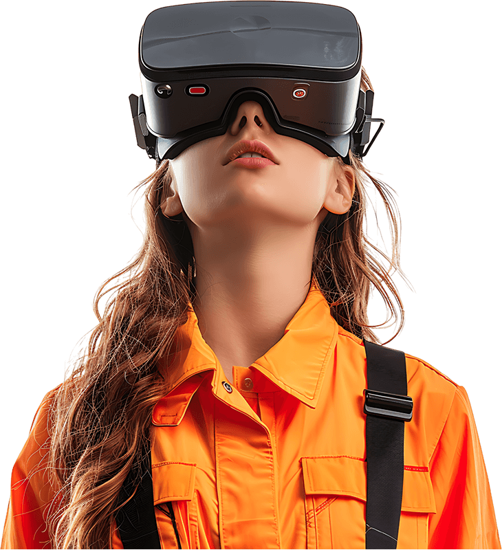
VR innovations
Explore endless possibilities where your wildest dreams become virtual reality.
Stakeholder Interviews
Conducted sessions with first responders, emergency managers, and Texas DPS officials to understand pain points and operational challenges.
Contextual Inquiry
Observed disaster response training exercises to map workflows and identify integration opportunities.
Market & Competitive Analysis
Benchmarked existing drone and AI solutions to determine gaps and industry best practices.
Stakeholder Interviews
Conducted sessions with first responders, emergency managers, and Texas DPS officials to understand pain points and operational challenges.
Stakeholder Interviews
Conducted sessions with first responders, emergency managers, and Texas DPS officials to understand pain points and operational challenges.
VR innovations
Explore endless possibilities where your wildest dreams become virtual reality.
Stakeholder Interviews
Conducted sessions with first responders, emergency managers, and Texas DPS officials to understand pain points and operational challenges.
Contextual Inquiry
Observed disaster response training exercises to map workflows and identify integration opportunities.
Market & Competitive Analysis
Benchmarked existing drone and AI solutions to determine gaps and industry best practices.
Approach
Design & Development
Design & Development
Design & Development
Building on our research insights, we developed a scalable AI-powered solution tailored to first responders' needs. Our design process focused on seamless integration, real-time analytics, and ethical considerations to ensure both usability and effectiveness.
Building on our research insights, we developed a scalable AI-powered solution tailored to first responders' needs. Our design process focused on seamless integration, real-time analytics, and ethical considerations to ensure both usability and effectiveness.
Building on our research insights, we developed a scalable AI-powered solution tailored to first responders' needs. Our design process focused on seamless integration, real-time analytics, and ethical considerations to ensure both usability and effectiveness.
Workflow Mapping
Identified where AI-powered drones could be most effective in fire response operations.
Workflow Mapping
Identified where AI-powered drones could be most effective in fire response operations.
Workflow Mapping
Identified where AI-powered drones could be most effective in fire response operations.
Computer Vision & AI Model Selection
Researched and recommended deep learning models for real-time fire detection, heat mapping, and predictive analysis.
Computer Vision & AI Model Selection
Researched and recommended deep learning models for real-time fire detection, heat mapping, and predictive analysis.
Computer Vision & AI Model Selection
Researched and recommended deep learning models for real-time fire detection, heat mapping, and predictive analysis.
Geospatial Data Processing
Integrated Geographic Information Systems (GIS) with AI models to enhance mapping accuracy.
Geospatial Data Processing
Integrated Geographic Information Systems (GIS) with AI models to enhance mapping accuracy.
Geospatial Data Processing
Integrated Geographic Information Systems (GIS) with AI models to enhance mapping accuracy.
Edge Computing for Real-Time Analysis
Designed an architecture where AI models run on edge devices mounted on drones to process data instantly without cloud dependencies.
Edge Computing for Real-Time Analysis
Designed an architecture where AI models run on edge devices mounted on drones to process data instantly without cloud dependencies.
Edge Computing for Real-Time Analysis
Designed an architecture where AI models run on edge devices mounted on drones to process data instantly without cloud dependencies.
Integration Prototyping
Developed conceptual prototypes demonstrating how drones could relay live data to command centers and first responders.
Integration Prototyping
Developed conceptual prototypes demonstrating how drones could relay live data to command centers and first responders.
Integration Prototyping
Developed conceptual prototypes demonstrating how drones could relay live data to command centers and first responders.
Ethical & Privacy Considerations
Addressed potential concerns related to AI decision-making, data privacy, and safety regulations.
Ethical & Privacy Considerations
Addressed potential concerns related to AI decision-making, data privacy, and safety regulations.
Ethical & Privacy Considerations
Addressed potential concerns related to AI decision-making, data privacy, and safety regulations.

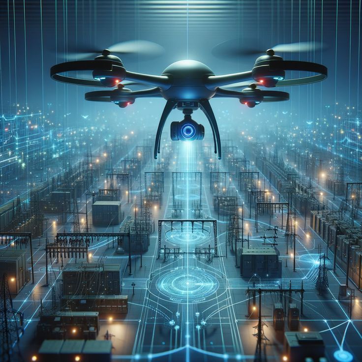
Solution
A real-time AI-powered drone system designed to enhance fire mapping and emergency response efficiency.
This AI-powered drone system leverages cutting-edge technology to provide real-time situational awareness, automate hazard detection, and support critical decision-making during emergency situations. By combining advanced machine learning and drone capabilities, it helps emergency responders quickly assess fire conditions, track fire spread, and optimize response strategies for improved safety and efficiency.
This AI-powered drone system leverages cutting-edge technology to provide real-time situational awareness, automate hazard detection, and support critical decision-making during emergency situations. By combining advanced machine learning and drone capabilities, it helps emergency responders quickly assess fire conditions, track fire spread, and optimize response strategies for improved safety and efficiency.

Real-Time Monitoring
AI drones offer live coverage of disaster zones for immediate situational awareness.
Real-Time Monitoring
AI drones offer live coverage of disaster zones for immediate situational awareness.
Real-Time Monitoring
AI drones offer live coverage of disaster zones for immediate situational awareness.
Hazard Detection
AI identifies and classifies risks in real-time to support emergency decisions.
Hazard Detection
AI identifies and classifies risks in real-time to support emergency decisions.
Hazard Detection
AI identifies and classifies risks in real-time to support emergency decisions.
Fire Mapping
AI analyzes drone footage to monitor fire spread & recommend containment strategies.
Fire Mapping
AI analyzes drone footage to monitor fire spread & recommend containment strategies.
Fire Mapping
AI analyzes drone footage to monitor fire spread & recommend containment strategies.
Risk Forecasting
Machine learning predicts fire risks and identifies potential danger zones for proactive response.
Risk Forecasting
Machine learning predicts fire risks and identifies potential danger zones for proactive response.
Risk Forecasting
Machine learning predicts fire risks and identifies potential danger zones for proactive response.
System Integration
Works seamlessly with GIS, incident management, and command systems for smooth coordination.
System Integration
Works seamlessly with GIS, incident management, and command systems for smooth coordination.
System Integration
Works seamlessly with GIS, incident management, and command systems for smooth coordination.
Flight Optimization
Drones adjust flight paths dynamically based on fire conditions and environmental factors using AI.
Flight Optimization
Drones adjust flight paths dynamically based on fire conditions and environmental factors using AI.
Flight Optimization
Drones adjust flight paths dynamically based on fire conditions and environmental factors using AI.
Insights & Feedback
Stakeholder Insights on AI and Drone Integration in Emergency Response
Stakeholder Insights on AI and Drone Integration in Emergency Response
Stakeholder Insights on AI and Drone Integration in Emergency Response
Through discussions with firefighters, Texas DPS, Crisis Technologies innovation Lab, and FirstNet by AT&T, we gathered valuable feedback on the integration of AI in emergency response. Their insights helped shape our drone system proposal, ensuring it addresses real-world needs and enhances fire mapping, response times, and situational awareness for first responders.
Through discussions with firefighters, Texas DPS, Crisis Technologies innovation Lab, and FirstNet by AT&T, we gathered valuable feedback on the integration of AI in emergency response. Their insights helped shape our drone system proposal, ensuring it addresses real-world needs and enhances fire mapping, response times, and situational awareness for first responders.
Jocob Simons
Jocob Simons
Jocob Simons
Firefighter, Indiana Fire Department
"As we continue to implement new technologies in our operations, AI has already proven to be a game-changer. The real-time insights it provides during fires have significantly improved our decision-making and response times, making our jobs safer and more efficient."
"As we continue to implement new technologies in our operations, AI has already proven to be a game-changer. The real-time insights it provides during fires have significantly improved our decision-making and response times, making our jobs safer and more efficient."
"As we continue to implement new technologies in our operations, AI has already proven to be a game-changer. The real-time insights it provides during fires have significantly improved our decision-making and response times, making our jobs safer and more efficient."
40%
Better situational awareness in the field.
40%
Better situational awareness in the field.
40%
Better situational awareness in the field.
25%
Faster response times with AI.
25%
Faster response times with AI.
25%
Faster response times with AI.

"AI-driven technologies like these drones are essential to modernizing public safety communications, ensuring first responders are equipped with the tools they need to act swiftly and effectively."
Travis Hull
FirstNet by AT&T
"AI-driven technologies like these drones are essential to modernizing public safety communications, ensuring first responders are equipped with the tools they need to act swiftly and effectively."
Travis Hull
FirstNet by AT&T
"AI-driven technologies like these drones are essential to modernizing public safety communications, ensuring first responders are equipped with the tools they need to act swiftly and effectively."
Travis Hull
FirstNet by AT&T

"By harnessing the power of AI and drones, we are revolutionizing emergency response, transforming how first responders tackle crises with precision and speed."
Randy Kerr
AT&T
"By harnessing the power of AI and drones, we are revolutionizing emergency response, transforming how first responders tackle crises with precision and speed."
Randy Kerr
AT&T
"By harnessing the power of AI and drones, we are revolutionizing emergency response, transforming how first responders tackle crises with precision and speed."
Randy Kerr
AT&T

"The integration of AI has drastically improved our ability to respond to disasters in real time, providing us with critical insights that directly impact lives and safety."
Jason Day
Texas DPS
"The integration of AI has drastically improved our ability to respond to disasters in real time, providing us with critical insights that directly impact lives and safety."
Jason Day
Texas DPS
"The integration of AI has drastically improved our ability to respond to disasters in real time, providing us with critical insights that directly impact lives and safety."
Jason Day
Texas DPS
Project Outcomes
Impact
This project is set to significantly improved emergency response capabilities, delivering faster decision-making, enhanced safety, and greater operational efficiency through the integration of AI-powered drones.
30%
Faster Decision-Making
Enabled situational awareness within 5 minutes, reducing response time and improving decision-making efficiency.
Enabled situational awareness within 5 minutes, reducing response time and improving decision-making efficiency.

40% Reduction in Manual Workload
Automated fire analysis, streamlining operations and allowing first responders to focus on critical tasks.
40% Reduction in Manual Workload
Automated fire analysis, streamlining operations and allowing first responders to focus on critical tasks.
40% Reduction in Manual Workload
Automated fire analysis, streamlining operations and allowing first responders to focus on critical tasks.
Deployed a high-tech AI-powered drone system for real-time fire mapping and emergency response, optimizing disaster management for large-scale public safety initiatives.
Deployed a high-tech AI-powered drone system for real-time fire mapping and emergency response, optimizing disaster management for large-scale public safety initiatives.
100+ Million Dollar Investment
$100M+
$100M+
$100M+
Investment in AI drones
Investment in AI drones
10k+
10k+
10k+
Lives potentially saved
Lives potentially saved
5k+ hrs
5k+ hrs
5k+ hrs
Saved in manual fire mapping
Saved in manual fire mapping
30%
30%
30%
Faster decision-making
Faster decision-making
Reflection
Key Learnings
Key Learnings
This project demonstrated how AI enhances emergency response through real-time data and seamless integration. Future improvements, like thermal imaging and drone coordination, could further boost the system’s impact on public safety.
This project demonstrated how AI enhances emergency response through real-time data and seamless integration. Future improvements, like thermal imaging and drone coordination, could further boost the system’s impact on public safety.
This project demonstrated how AI enhances emergency response through real-time data and seamless integration. Future improvements, like thermal imaging and drone coordination, could further boost the system’s impact on public safety.
AI-driven insights enhance emergency response
Understanding user workflows is crucial
Balancing innovation with feasibility is essential
Edge AI and real-time analytics are game-changers
AI-driven insights enhance emergency response
Understanding user workflows is crucial
Balancing innovation with feasibility is essential
Edge AI and real-time analytics are game-changers
AI-driven insights enhance emergency response
Understanding user workflows is crucial
Balancing innovation with feasibility is essential
Edge AI and real-time analytics are game-changers
Role & Contributions
Key Responsibilities in the AI-Powered Drone Project
I led user research, mapping workflows, and identifying pain points to improve first responder efficiency. I researched and recommended AI models for fire mapping and developed prototypes, testing them with first responders to ensure real-world viability.
I led user research, mapping workflows, and identifying pain points to improve first responder efficiency. I researched and recommended AI models for fire mapping and developed prototypes, testing them with first responders to ensure real-world viability.
I led user research, mapping workflows, and identifying pain points to improve first responder efficiency. I researched and recommended AI models for fire mapping and developed prototypes, testing them with first responders to ensure real-world viability.

User Research
Led interviews, contextual inquiries, and competitive analysis to understand first responders' needs.
User Research
Led interviews, contextual inquiries, and competitive analysis to understand first responders' needs.
User Research
Led interviews, contextual inquiries, and competitive analysis to understand first responders' needs.

Workflow Mapping & Integration
Mapped workflows, identified pain points, and streamlined operations.
Workflow Mapping & Integration
Mapped workflows, identified pain points, and streamlined operations.
Workflow Mapping & Integration
Mapped workflows, identified pain points, and streamlined operations.

AI Model & Prototyping
Researched AI models, designed prototypes, and tested with first responders.
AI Model & Prototyping
Researched AI models, designed prototypes, and tested with first responders.
AI Model & Prototyping
Researched AI models, designed prototypes, and tested with first responders.
Tools & Methods
Tools & Methods
Tools & Methods
Tools & Methods
This project leveraged a range of advanced technologies and methods to create a practical AI-powered drone system for emergency response, incorporating AI modeling, real-time analytics, and user-centered design.

Computer Vision
TensorFlow
User Interviews
Spatiotemporal Data Analysis
Computer Vision
AI Consulting
Competitive Analysis
Drone Path Planning
Usability Testing
Computer Vision
TensorFlow
User Interviews
Spatiotemporal Data Analysis
Computer Vision
AI Consulting
Competitive Analysis
Drone Path Planning
Usability Testing
Computer Vision
TensorFlow
User Interviews
Spatiotemporal Data Analysis
Computer Vision
AI Consulting
Competitive Analysis
Drone Path Planning
Usability Testing